Delib has launched a new geospatial product: Citizen Space Geospatial.
It’s kind of a big deal.
What is it?
Citizen Space Geospatial can be added to an existing Citizen Space subscription (or purchased alongside a new subscription for new customers).
It was designed and built over the course of a year, based on user research with over 20 different organisations.
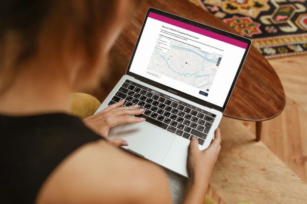
Citizen Space Geospatial harnesses the full potential of geospatial data in a way that’s easy to use and understand. It has the power to fundamentally change the way place-based engagement is done.
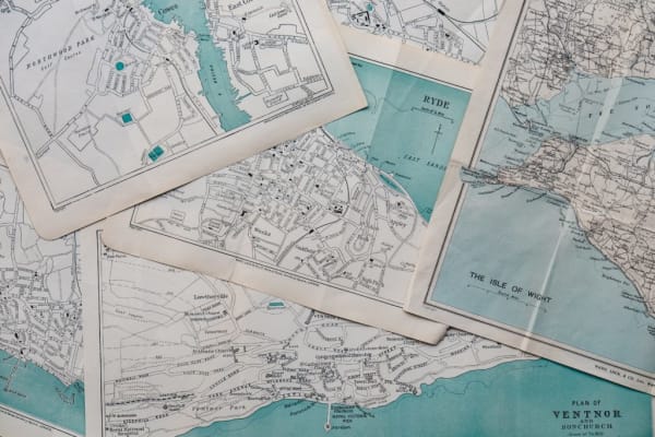
Paper processes are so last year.
The build work that went into it was interesting and you can read more about it in the following companion articles:
What does it do?
Much more than simply pins on maps, our geospatial product adds geospatial capability to every stage of the engagement process – including analysis and reporting. It’s fully interactive, accessible, and supports a whole range of place-based democratic processes.
Citizen Space Geospatial allows for seamless flow of GIS data across an organisation.
Citizens can:
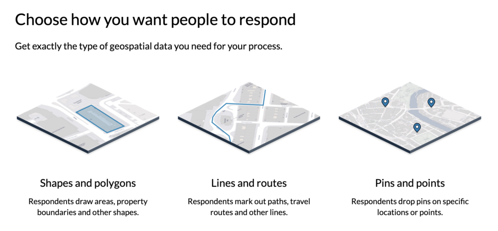
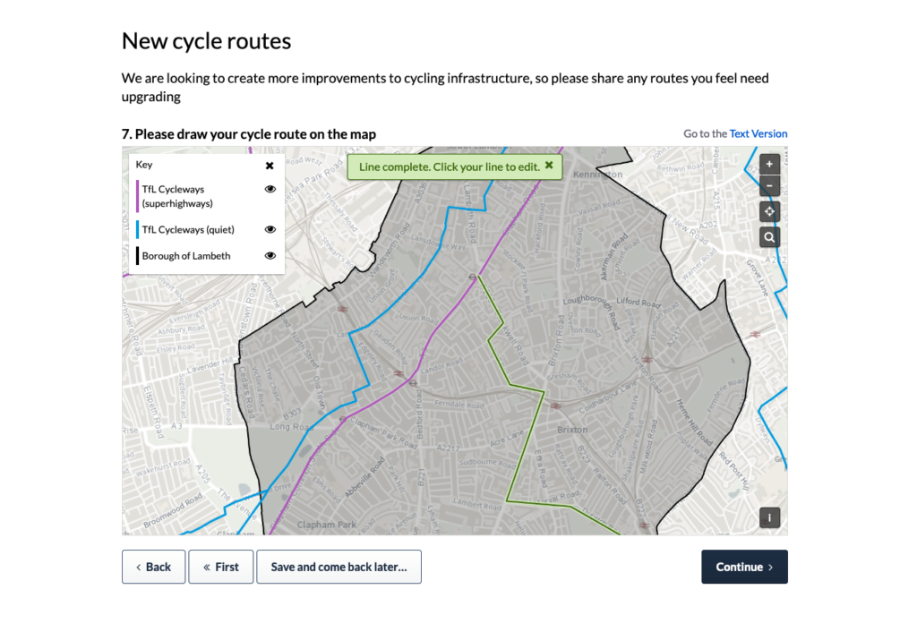
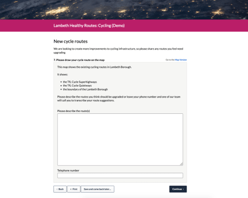
- draw a route, e.g. in consultations about active travel
- draw a polygon/shape, e.g. in consultations about site allocation (AKA Call for Sites)
- or drop a pin in basic pin-on-map exercises
Administrators can:
- import and export geospatial information in whatever format is used by their organisation
- pull in data from other systems e.g. street reporting or GIS data showing air quality
- use their choice of base maps and layers, depending on what’s appropriate to the exercise
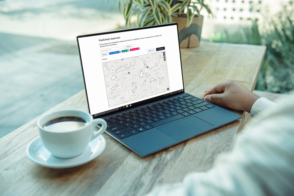
Unlike other geospatial engagement platforms, we have engineered powerful geospatial back-end capability and reporting tools. The data that’s collected can be displayed in an interactive map which can be saved as an image and inserted into reports. Admins can view geospatial responses by area, respondent type or demographic. And the data is correctly translated into whichever format is required.
This means responses don’t just look good – they convert into beautiful, valuable data that can give planners and other public officers rich, unique insights which can easily be plugged into a GIS system if an organisation has one.
Who is it for?
For public officials: Our geospatial capability is for anyone working in a public body who’s sick of endless PDFs and scanned paper maps. For anyone running engagement with a spatial element – and nowadays, that’s most engagement. And it’s not just for geospatial experts or organisations with fully-fledged GIS systems; it can be used by everyone, regardless of whether they know a lot or a little about geospatial information.
For citizens: This product makes the process of taking part in democratic exercises simple and engaging. From stakeholders who no longer have to draw on a printed map and upload it, to road users who want a better way to comment on travel routes, our accessible and intuitive platform allows the public to meaningfully share their opinions on decisions that affect the areas they care about.
Our new product adds geospatial capability to every stage of the consultation and engagement process – including analysis and reporting.
What does it solve?
It’s a digital intervention into the paper-heavy processes involved in spatial, transport, environment, and other types of planning. For too long, place-based democracy has been hobbled by lengthy, clunky legacy processes and technology.
For example, in Call for Sites exercises, planners and stakeholders would need to print out a copy of a digital map, draw a shape on it, scan it and reupload it.
Citizen Space Geospatial allows users to replace paper processes and eliminate manual data entry completely.
It makes it far, far easier for citizens to share and for admins to understand location-based activity, like active travel – without a competent geospatial engagement tool this is extremely hard to capture.
And it solves problems of interoperability with other GIS systems due to its ability to accurately transform and export data into an organisation’s preferred system. A real, meaningful shift to data, not documents.
The climate crisis and COVID-19 have made it clear that sweeping, structural changes to our towns, cities and rural areas are needed if we’re to be ready for the future. We have to modernise the places we live and work, and the ways we get between them.
As such, most local policy decisions now have a spatial consideration, from how we reduce our transport systems’ impact on the environment to how our cities economically evolve to adapt to more people working from home.
Planning departments are key in this transformation, but planning itself is also undergoing much-needed reform and modernisation. The old closed system of paper documents (Beware of the leopard) is on the way out, evolving to one focused on openness, transparency and data.
The future of place-based democracy is one that uses useful and diverse geospatial data as part of a more open and transparent way of working. It’s time that the public is given more control over the decisions that affect us and our neighbourhoods. The time is now.
Introducing place-based engagement with Citizen Space Geospatial
Include maps and geospatial data throughout your consultation and engagement activities.
We’re confident that Citizen Space Geospatial solves a lot of problems for a lot of people. But who defines those problems and how specifically do you solve them?
Citizen Space Geospatial was designed based on user research involving over 20 government organisations. You can read about the user research journey here.
How did we go about building Citizen Space Geospatial? What were the challenges? You can read about the engineering journey here.
How can geospatial tools include people who, for whichever reason, can’t use a map? Read about how we designed for accessibility and inclusion.
To find out more about Citizen Space Geospatial book a demo and we’ll walk you through it.
